|
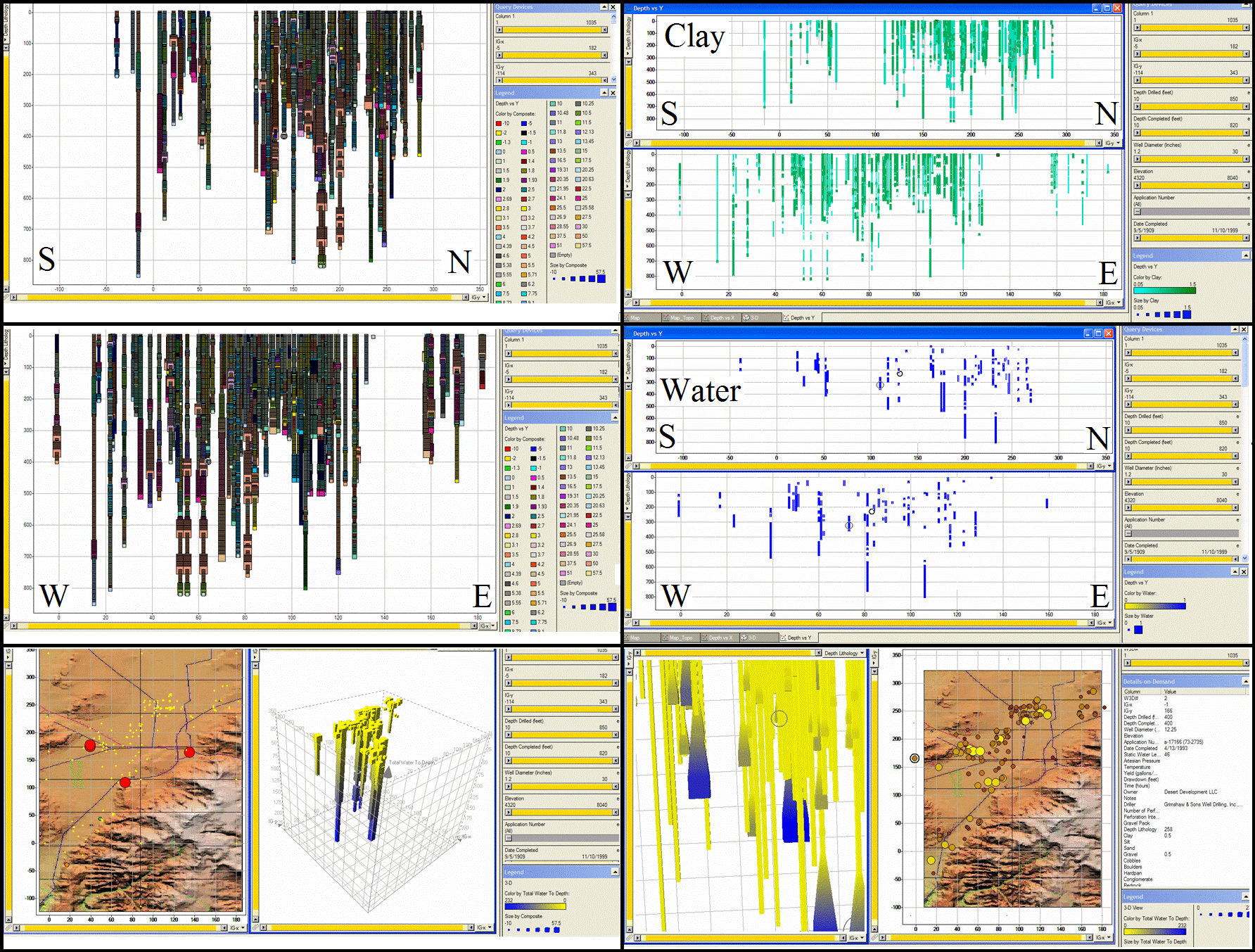
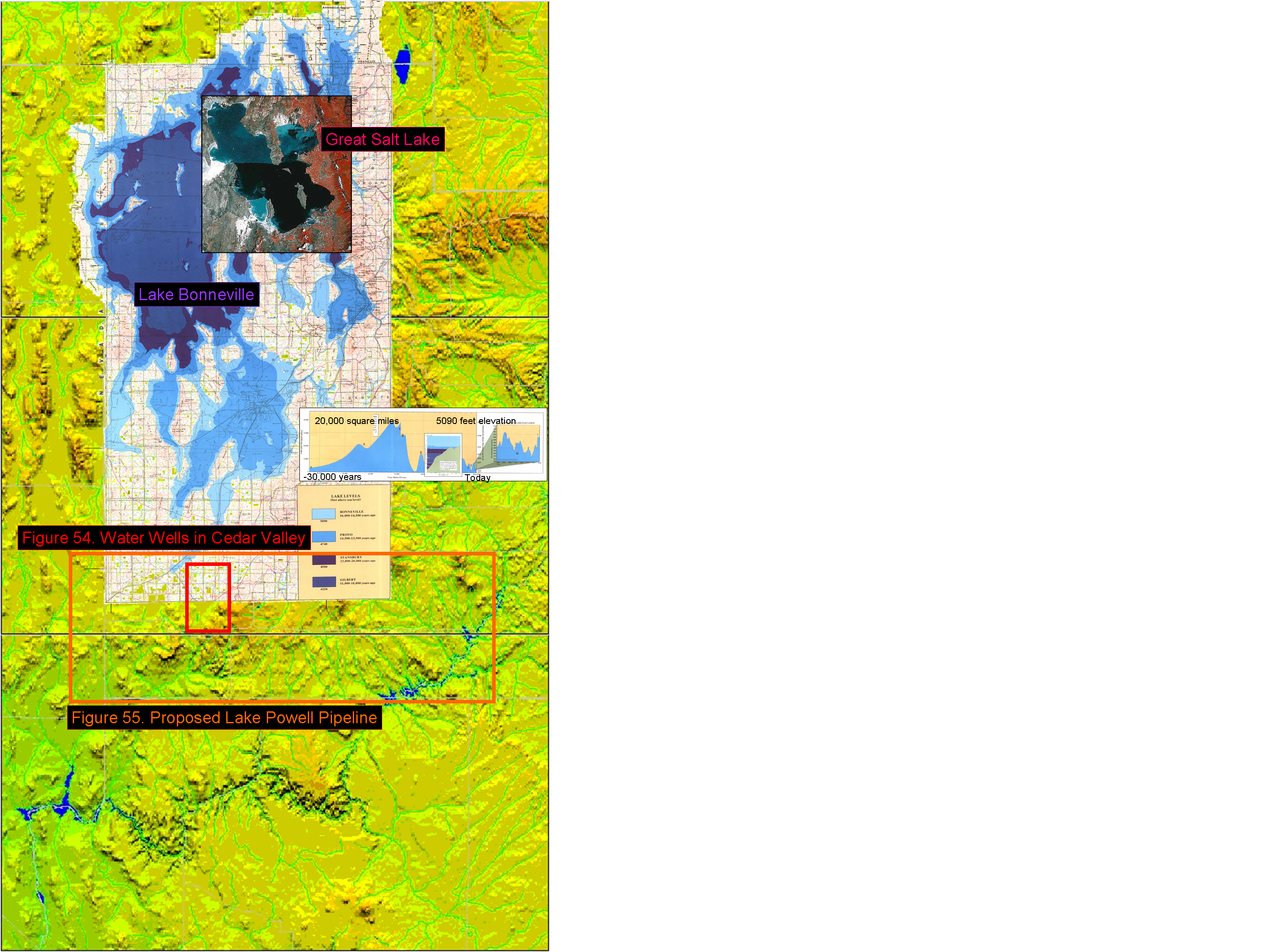
I initiated this project to study the water wells in Cedar Valley. Only working on it as time allows, it is also a project with no other funding source. One result is the correlations are not well developed yet. Having paid for collection of the data, and expecting to develop improved results over time, which will be substituted for Figure 54, I felt it appropriate to include this example to demonstrate how salt from a large inland sea can be buried by natural depositional processes in the mountains, in the same way salt is buried in the oceans. Cedar Valley just happens to be at the southern end of one of the largest inland lakes to have existed in North America: Lake Bonneville.
Lake Bonneville was the prehistoric lake that covered much of North America's Great Basin (see Figure 56). The best know extent of the lake was formed about 32,000 years ago and existed until about 16,800 years ago, when most of the water in the lake flowed out through a breach in Red Rock Pass in Idaho. This flood is estimated to have lasted about a year, and took the lake from the Bonneville Bench, at approximately 5,100 feet (1,555 meters), down 350 feet (105 meters) to the Provo level, where it remained for about 500 years.3.168 This was a much smaller, much later, and very similar catastrophic event to the Atlantic Ocean breaching Gibraltar and filling the Mediterranean Sea. At its height, the lake reached from Southern Idaho to Cedar Valley in Southern Utah. Rush Lake and the Little Salt Lake in Cedar Valley and Parowan Valley, respectively, are considered remnants of Lake Bonneville, although not shown on the map in Figure 56. At it's height, the lake was 1,000 feet (305 meters) deep, and covered about 19,700 square miles (51,000 square kilometers). There is geological evidence that the lake may have evaporated and reformed as many as 28 times in the last 3 million years.3.168
To highlight variations in the size and levels of the lake, a chart prepared by the Utah Geological Survey and published with the map of Lake Bonneville was overlaid on Figure 56. Then to highlight how much smaller The Great Salt Lake is, a satellite photo was overlaid on the Lake Bonneville map. The relevance of Lake Bonneville to this discussion is that it was the source of the salt flats in northwestern Utah, as well as the salty Sevier Lake in Central Utah and The Great Salt Lake in northern Utah. The Great Salt Lake and the Dead Sea were presented at the beginning of this section as modern analogs to the ancient sources of salt which became modern salt domes. These geologic frameworks and processes have been around for a very long time.
|