|

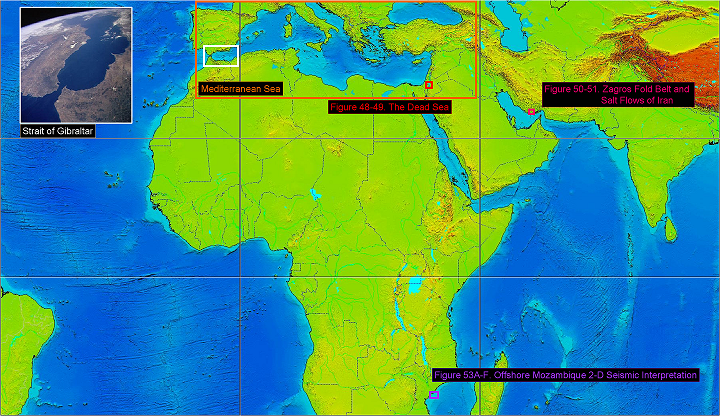
Figure 52 Mediterranean Sea and Mozambique Location Map. The image of the Strait of Gibraltar is from Wikipedia.3.161.
As shown on Figure 52, the Zambezi River basin sits off of southeast Africa. Global tectonic plate spreading centers can be recognized by the lighter bathymetry colors between South America and Africa, and similar colors coming out of the Red Sea south of Saudi Arabia and north of Madagascar. Note there has not been any compressional tectonics tied to where the Zambezi River flows into the Indian Ocean for a very long time frame. Tectonically, this part of the world has been very stable and under no geologic compression since the supercontinent of Pangaea broke up in the early to mid Jurassic,3.164 about 175 million years ago. This means sediments from the Zambezi River and it's predecessor rivers have simply dumped their sediment load into the Indian Ocean as Antarctica has moved to the south and Madagascar has moved further to the north slower than India, which rammed itno the Asian plate and created the Himalaya Mountains.
|